Last updated on 28 August 2025
The earliest map we have seen is Sandersons Map from 1835. Tollerton Parish is shown with the main elements being Tollerton Hall (named as Roclavaston Manor), the Lodge and Hoe Hill Farm. Warby Gate is also shown but we are not aware what this was but if you ask Google for a definition it could be a Watcher of a farmstead. It may be a Gate that led to the Hall (there is a footpath in the map). The map also shows the ‘River Torr’ which we now refer to as Polser Brook.

The next picture is the same map on a larger scale. No Farms are shown but you can clearly see the lake.

If you access Google Maps today (March 2023 – https://www.google.com/maps/@52.9084903,-1.0872134,15z ), it details all the present businesses that are in our area as well as the roads.

This map show where the Windmills were situated. The marks are small so you need your magnifying glasses on but several windmills are denoted: Tollerton, Cotgrave, Plumtree – it seems that nearly every village had its own windmill at one time. (Photo taken of larger map by courtesy of Hazel Salisbury)
Footpaths
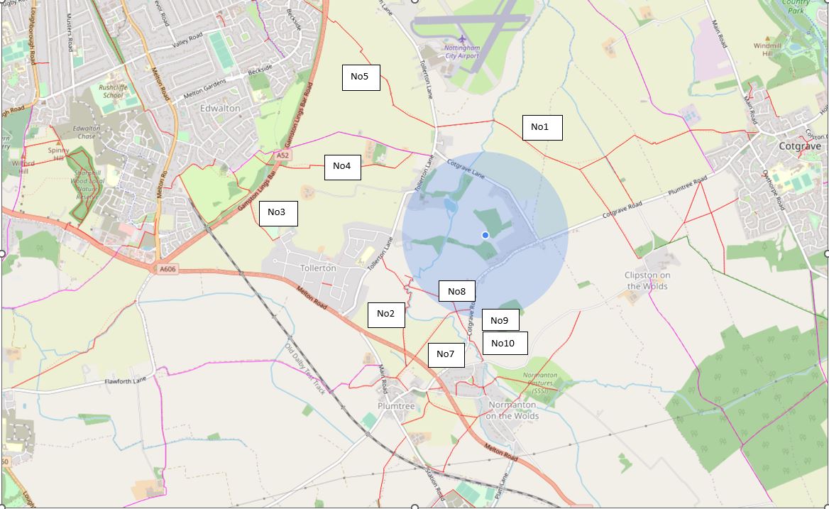
2/11/98 Tollerton has 8 foot paths totalling approx. 6.6kms & 1 bridleway of 1.3km
- Toll Lane to brook to boundary 1 km
- Toll Lane to beetfield to A606 1.1 km
- Open space to field to A52 0.4 km
- A52 to Little Lane 1.2 km
- Toll Lane to Hill Farm to A52 1.5 km
- Missing
- Cotgrave Road to A606 0.7 km
- Brook to footpath 10 0.4 km
- Footpath 8 to Cotgrave Road 0.3 km
- Where No 8 finishes and joins with 7 and 10 (leads to A606)
Further to this page going live, Liam Kershaw contacted us and has provided more maps that were at the hall. The first being a 19th Century Plan of Tollerton Parish. The letters and numbers denote fields and each would have been assigned to particular farmers:

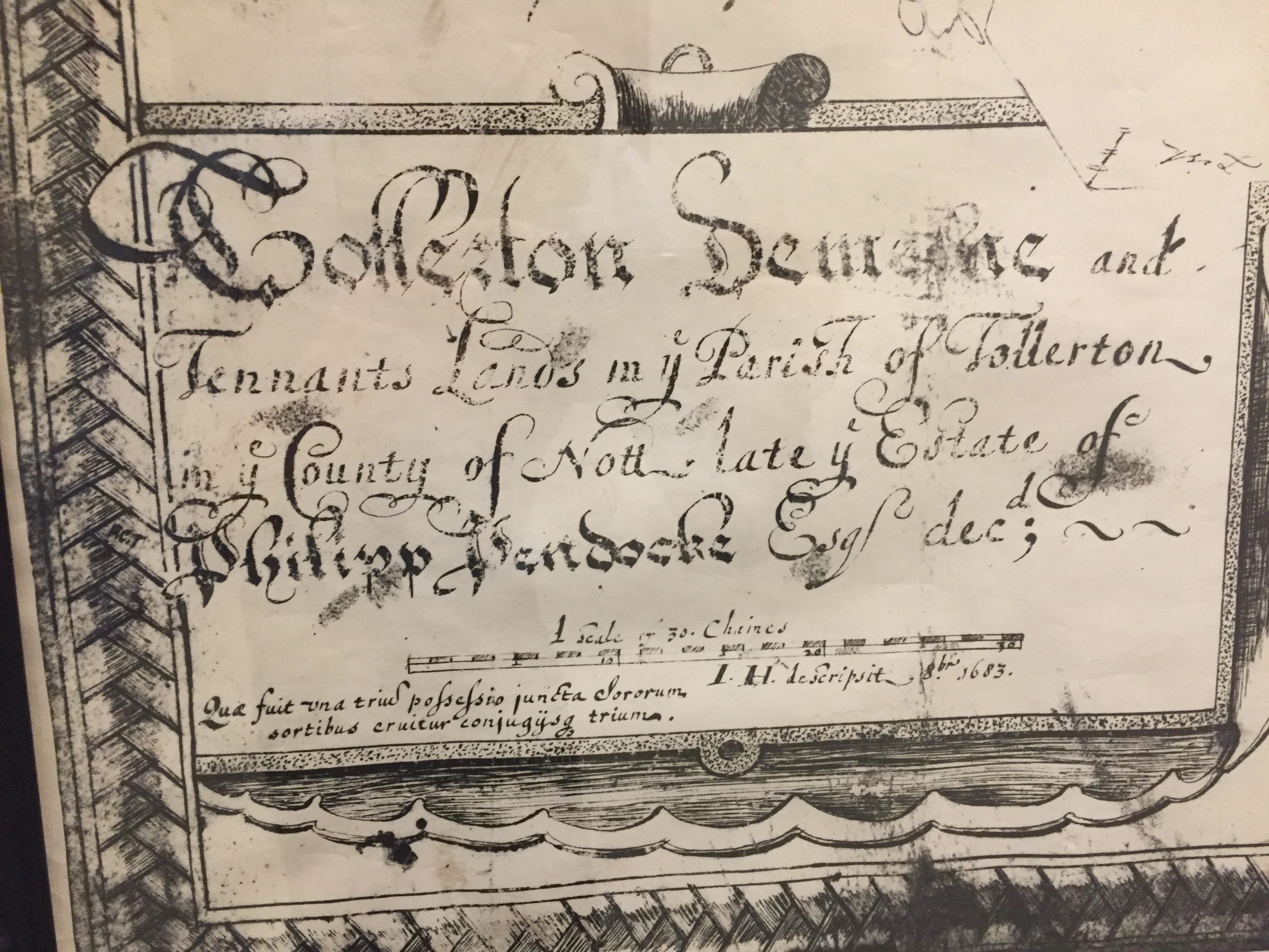
The next map shows the estate of Philip Pendock of 1683.

Not an easy map to read but Liam has broken it down into sections which makes it a little easier!
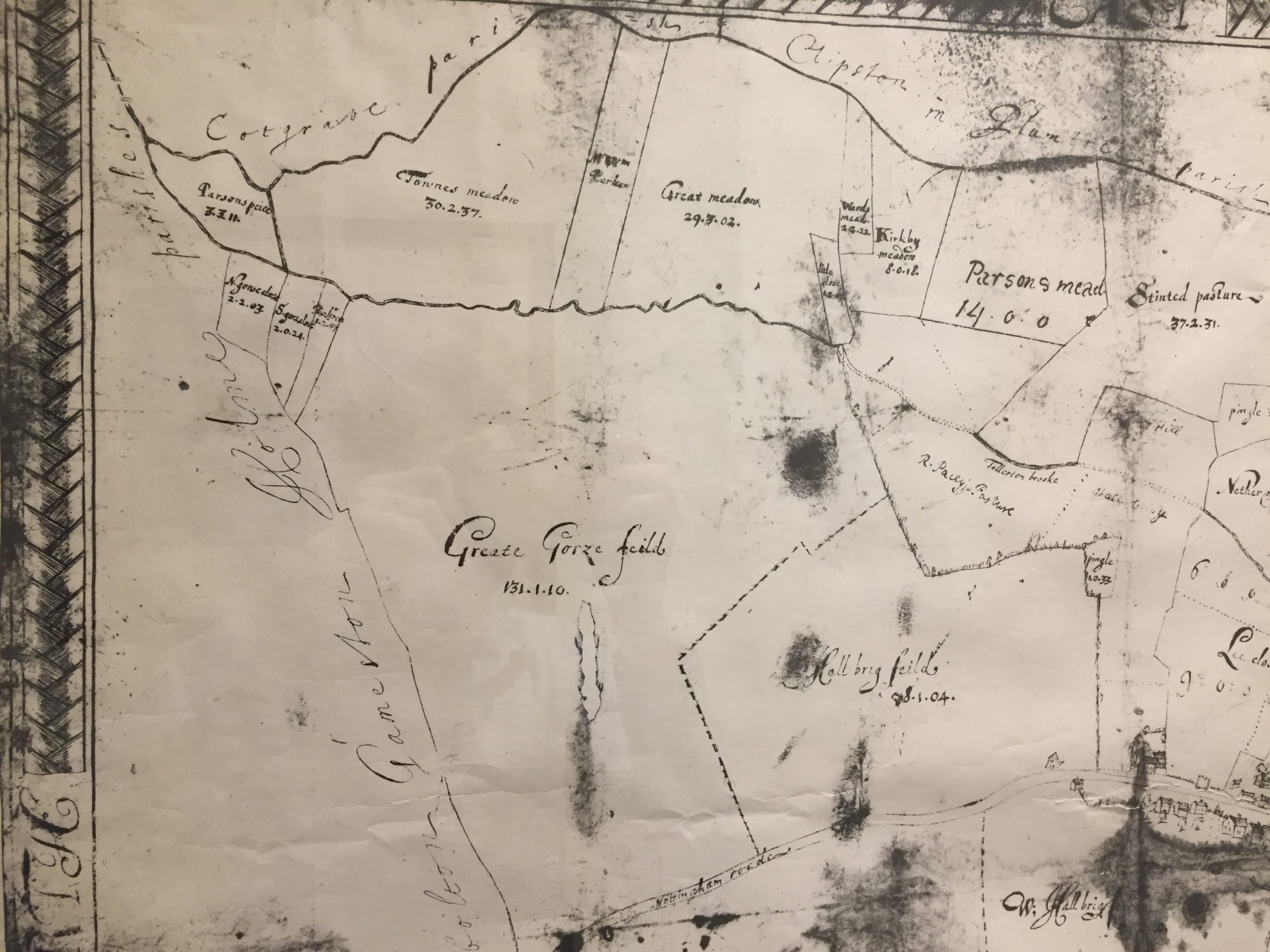
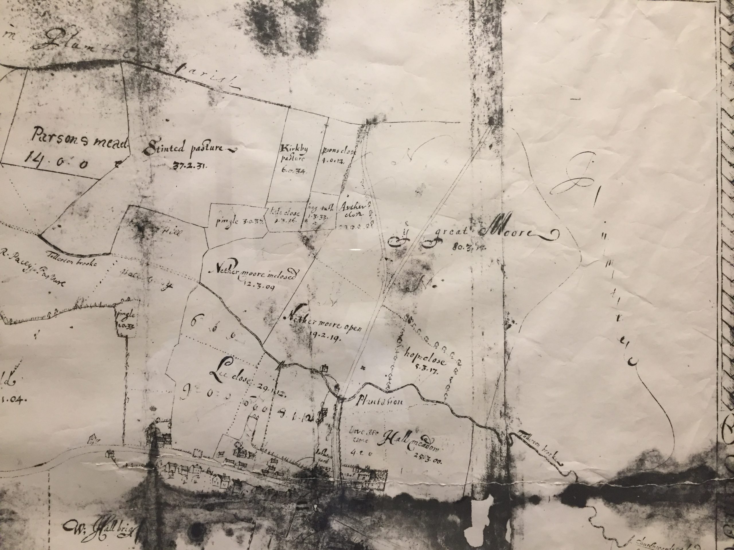
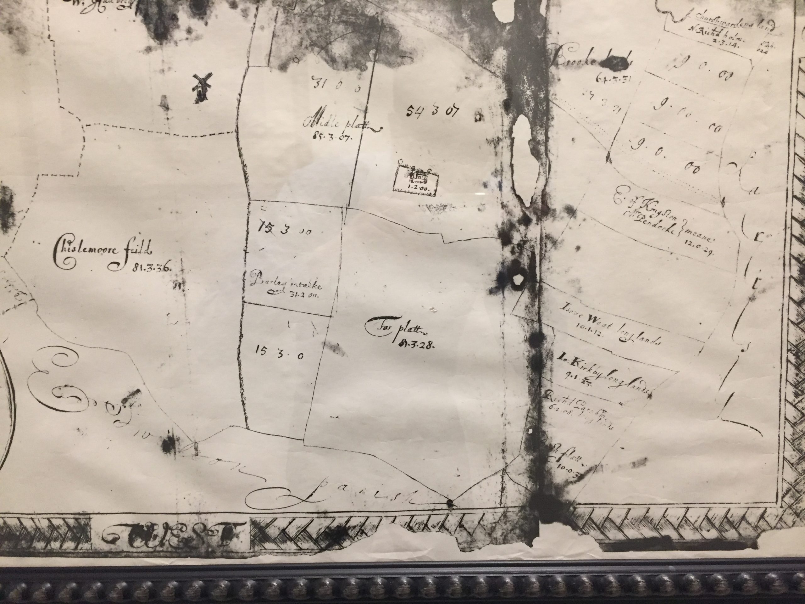
It’s interesting to see how the few fields of 1683 have been broken down and made into smaller field in the 19th Century map.
My thanks to Liam for his help and support.